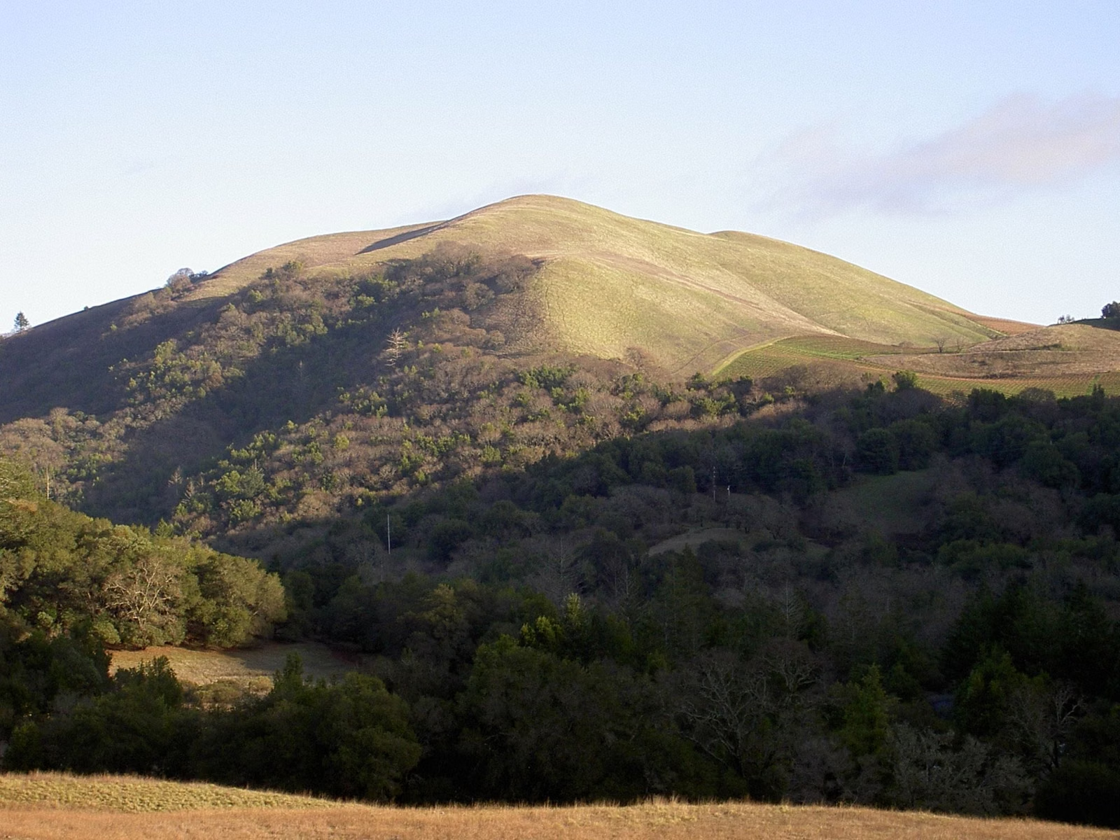
Sugarloaf Ridge State Park —
Your Complete Guide
Ridges, redwoods and a seasonal waterfall above the Sonoma Valley: 25 miles of trails, a creekside campground and a public observatory, open every day.
What is Sugarloaf Ridge State Park?
Sugarloaf Ridge State Park is a state park in the Mayacamas Mountains above Kenwood, between the Sonoma and Napa valleys, about an hour from San Francisco. It has 25 miles of trails, a 2,729-foot summit on Bald Mountain, a 25-foot seasonal waterfall on Sonoma Creek, a year-round campground with 47 family sites, and the public Robert Ferguson Observatory. It is open 6 a.m. to 10 p.m. daily, and day use is $10 per vehicle.
The park is owned by California State Parks but run day to day by the nonprofit Sonoma Ecology Center, which took over in 2012 and keeps it open on visitor fees, memberships and donations. The observatory is a separate nonprofit, the Valley of the Moon Observatory Association (who runs the park).
Before you go, keep three things in mind. Dogs can come to the campground and picnic area but not on any trail (dog rules). There is no free parking anywhere on Adobe Canyon Road, so plan to pay day use even for a short stop (parking). And summers are hot, often in the 90s, so hike early and carry water (weather).
Sugarloaf Ridge State Park at a Glance
Things to Do at Sugarloaf Ridge
A summit, a waterfall, a campground and a telescope. Pick what you came for.

Bald Mountain
5.6 miles round trip and 1,529 feet of gain to the park's 2,729-foot high point.
Summit Route →
Sonoma Creek Waterfall
A 25-foot fall in the redwood canyon that runs after winter rain, 0.4 to 2 miles round trip.
3 Ways There →
Camping
47 family sites around a creekside meadow from $35 a night, plus a group camp and glamping tents.
Sites & Fees →
Robert Ferguson Observatory
Night and solar viewing on select weekends through a 40-inch telescope, run by a separate nonprofit.
Star Parties →
Hiking Trails
25 miles of trails, from the 1-mile Creekside Nature Trail to the 8.2-mile Big Loop.
Best Hikes →
Weather & Seasons
Spring wildflowers, hot dry summers and wet winters that bring the waterfall to life.
When to Go →Popular Hikes at Sugarloaf Ridge
Five favorites from the park operator's hiking guide.
The summit hike, via the Stern or Lower Bald Mountain Trail.
Through the redwoods to the seasonal waterfall.
A two-hour loop with spring flowers and views.
From the observatory along the Meadow Trail and Planet Walk.
A shady walk beside Sonoma Creek from the main day-use lot.
How to Get to Sugarloaf Ridge State Park
Highway 12 to Kenwood, then all the way up Adobe Canyon Road.
Park Address
2605 Adobe Canyon Road, Kenwood, CA 95452. About an hour from San Francisco. Directions.
Park Office
707-833-5712, 9 a.m. to 5 p.m. daily. Visitor Center open 9 a.m. to 5 p.m.. Hours & fees.
Pay to Park
No free parking on Adobe Canyon Road. Pay at the kiosk, pay station or online. Where to pay.
Frequently Asked Questions
What is the entry fee at Sugarloaf Ridge State Park?
$10 per vehicle, or $8 for seniors 62 and older, students and current or retired military. A $59 annual pass also covers Jack London State Historic Park.
What are the hours at Sugarloaf Ridge State Park?
Gates are open 6 a.m. to 10 p.m. daily; Visitor Center hours are 9 a.m. to 5 p.m..
Are dogs allowed at Sugarloaf Ridge State Park?
Only in the campground, picnic area and paved developed areas, on a six-foot-or-shorter leash. Dogs are not allowed on trails, dirt roads or in the backcountry.
Can you camp at Sugarloaf Ridge State Park?
Yes, year-round. There are 47 family sites at $35 a night ($45 premium), a group camp for up to 50 and seasonal glamping tents. ReserveCalifornia takes bookings six months out.
Is there a waterfall at Sugarloaf Ridge State Park?
Yes, a 25-foot seasonal waterfall on Sonoma Creek that flows after winter rains. The 2-mile Pony Gate-Canyon Loop is the recommended route.
How long is the Bald Mountain hike?
5.6 miles round trip with 1,529 feet of gain, about three hours, to the 2,729-foot summit.
Where is Sugarloaf Ridge State Park?
At 2605 Adobe Canyon Road, Kenwood, CA 95452, at the end of Adobe Canyon Road off Highway 12, about an hour from San Francisco and seven miles east of Santa Rosa.
Who runs Sugarloaf Ridge State Park?
California State Parks owns it; the nonprofit Sonoma Ecology Center has run it day to day since 2012. The Robert Ferguson Observatory is run by the Valley of the Moon Observatory Association.